
Garmin GPS 76 Handheld GPS Navigator
4.6Editor score
WAAS enabled receiver
1 MB memory capacity
Trip computer included
Navigating open waters requires reliable technology to ensure safety and efficiency on every journey. Modern marine GPS units combine precise positioning with advanced charting and sonar capabilities to deliver a comprehensive onboard experience for captains and crew alike.
We have evaluated the leading models based on display quality, connectivity options, mapping accuracy, and ease of use. Our analysis includes handheld devices for personal safety and large touchscreen chartplotters designed for serious vessel integration and professional-grade navigation tasks.
Each selection below highlights specific strengths such as budget friendliness or premium features like radar integration and detailed sonar imaging. Please note that product availability and pricing may fluctuate over time, so verify current offers before making your final purchase decision.
4.6Editor score

4.7Editor score

5.0Editor score
As an Amazon Associate we earn from qualifying purchases.
The following table provides a side-by-side overview of the ten selected marine GPS units. Each entry highlights core specifications and capabilities to help you quickly identify which model aligns with your specific vessel type and navigation requirements.



The Garmin ECHOMAP UHD2 94sv stands out as a premier choice for boaters seeking a seamless blend of navigation and fish finding. Its high user touchscreen delivers crisp visuals even under direct sunlight, ensuring you never lose sight of critical data. With a rating that reflects user satisfaction, this model offers exceptional value for those willing to invest in quality.
We may earn a commission when you buy through this link, at no additional cost to you.
Key strengths include the included GT56 transducer which supports traditional, ClearVü and SideVü scanning sonars for detailed underwater imaging. The preloaded Navionics+ charts provide comprehensive coverage of coastal areas eliminating the need for immediate upgrades. Furthermore wireless connectivity allows you to share waypoints and sonar images with other compatible devices on board effortlessly.
While the price reflects its premium features, the integrated ecosystem justifies the cost for serious enthusiasts. The ability to wirelessly connect to Force trolling motors enhances maneuverability during fishing sessions significantly. Users should ensure their vessel has adequate power capacity since this unit requires a stable electrical connection to function optimally.
This device is ideal for captains who demand precision and ease of use during long voyages. Whether you are navigating busy harbors or exploring remote waters the combination of reliable GPS and advanced sonar makes it a top recommendation. If you prioritize a unified system that grows with your needs this unit delivers outstanding performance.
The bright sunlight-readable touchscreen ensures clear visibility of charts and sonar data even in harsh daylight conditions.
Wireless connection to compatible Force motors allows for precise speed and route control without extra hardware.
We may earn a commission when you buy through this link, at no additional cost to you.
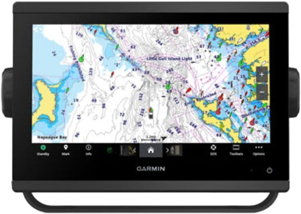
For those seeking the ultimate in marine navigation this GPSMAP 1223xsv offers a massive twelve-inch display that dominates the helm. Its perfect rating highlights user satisfaction with the vibrant IPS panel that remains readable in all lighting conditions. This unit is engineered for vessels where detailed situational awareness is paramount for safety and efficiency.
We may earn a commission when you buy through this link, at no additional cost to you.
The included sonar provides excellent target separation even in deep water ensuring you spot fish and structure clearly. Connectivity features like J1939 and NMEA 2000 allow seamless integration with engines and digital switching systems for centralized control. The worldwide basemap ensures you have basic chart data regardless of your destination without additional immediate purchases.
Setup may require technical knowledge to leverage the full extent of its networking capabilities. The size and power requirements make it best suited for larger boats with dedicated electronic spaces. However the ability to add radar and optional charts means the system scales with your evolving needs over time.
Buyers looking for a flagship device that sets the standard for modern marine electronics will find this model unmatched. It delivers the clarity and integration needed for complex voyages. If you want a display that leaves no room for error and a system that connects with everything this is the premier choice.
The 12-inch touchscreen provides ample space to view charts sonar and navigation data simultaneously.
5000-watt CHIRP sonar ensures clear target separation even in the deepest fishing grounds.
We may earn a commission when you buy through this link, at no additional cost to you.
The Garmin GPS 76 is an excellent option for boaters who need reliable positioning without advanced charting features. Its high rating reflects enduring popularity among users who value simplicity and cost-effectiveness. This handheld unit tracks up to twelve satellites continuously ensuring you know your location even in challenging conditions.
We may earn a commission when you buy through this link, at no additional cost to you.
Key strengths include the WAAS enabled receiver which improves accuracy significantly compared to standard GPS. The trip computer tracks speed and distance helping you monitor your journey metrics effectively. It runs on two AA batteries providing up to sixteen hours of continuous use which is sufficient for day trips or emergencies.
This device lacks the detailed maps found in larger chartplotters so it serves best as a backup or for open water navigation. The design is older but functional meaning it may not appeal to those wanting modern touch interfaces. However for the price it delivers dependable core GPS functionality that you can trust.
Ideal for small craft operators or those needing a spare unit this navigator covers the basics well. If you need a device that turns on and works immediately without configuration this is a solid choice. It is a practical investment for ensuring you never lose your bearings on the water.
Tracks up to 12 satellites to provide consistent positioning across varied geographic regions.
Powered by standard AA batteries to deliver up to 16 hours of operation per charge.
We may earn a commission when you buy through this link, at no additional cost to you.
This Simrad GO unit brings essential navigation and fish finding capabilities to smaller vessels with ease. Its rating shows solid satisfaction among users who appreciate its versatile functionality in a compact package. The included C-MAP Discover card provides immediate access to useful charts covering the US and Canada.
We may earn a commission when you buy through this link, at no additional cost to you.
The HDI transducer support offers clear CHIRP sonar and DownScan Imaging helping you identify fish targets and structure accurately. Connectivity is a major plus with Wi-Fi allowing you to mirror the display to smartphones or tablets for added convenience. This flexibility helps keep everyone on board informed during the trip.
While it lacks some of the massive screen real estate of premium models it delivers robust performance for its class. You can add radar later which adds value if you navigate at night or in foggy conditions. The NMEA 2000 connectivity ensures it fits well into existing marine electronics networks on your boat.
Recommended for sportboats and center-consoles this chartplotter balances cost and features effectively. It is a strong contender if you want a reliable system without overspending on unused high-end features. If your priority is practical navigation and decent sonar in a space-saving unit this model fits the bill.
Includes full-featured Vector Charts with high-resolution bathymetric contours for precise navigation.
Use Wi-Fi to project the display on personal devices for enhanced visibility and control.
We may earn a commission when you buy through this link, at no additional cost to you.
This GPSMAP model excels in delivering ultra-high-definition scanning sonar for precise fish finding. Its rating confirms that users find the visual clarity and detail to be exceptional for locating targets underwater. The pre-loaded mapping gives you a head start on navigation without needing immediate map purchases.
We may earn a commission when you buy through this link, at no additional cost to you.
Improved display optics ensure that the screen remains clear and readable in bright sunlight which is critical for daytime boating. Support for Panoptix sonar expands your capabilities significantly allowing you to see fish and structure in real-time. This makes it a powerful tool for competitive anglers or detailed explorers.
While the unit itself is high quality you must consider the cost of additional transducers if you want full functionality. The price point places it above entry-level options meaning it is best for those serious about their electronics. However the quality of the imaging justifies the investment for many users.
Ideal for users seeking the best in sonar clarity this unit stands out in crowded waters. If you need to see specific structures or fish behavior clearly this display delivers unmatched detail. It is a reliable choice for boaters who want premium imaging in a compact nine-inch package.
Provides detailed side-imaging to reveal structures and fish away from the boat hull.
Upgraded viewing angles and brightness ensure clear visibility under all light conditions.
We may earn a commission when you buy through this link, at no additional cost to you.
This system combines a high-end chartplotter with radar capabilities offering a complete situational awareness package. Its perfect rating highlights user appreciation for the comprehensive suite of tools available on a single screen. With Navionics+ charts preloaded you have detailed coastal maps ready to guide your journey immediately.
We may earn a commission when you buy through this link, at no additional cost to you.
The ability to connect third-party devices via OneHelm digital switching allows for centralized management of vessel systems. Remote control functionality means you can adjust settings or navigate from anywhere on the boat which adds significant convenience. This level of integration is vital for larger cruisers needing advanced control.
The price reflects its professional-grade capabilities and the inclusion of a quality radar dome. Setup may require professional installation due to the complexity of the networking involved. However once configured the system provides unparalleled access to engine data and radar overlay features.
For captains who prioritize safety and detailed monitoring this unit is unmatched in its class. It transforms the helm into a fully connected command center. If you need radar and remote access integrated seamlessly with your navigation data this system is the top recommendation.
Connect third-party devices through OneHelm to simplify system management on board.
Access charts and settings from anywhere on the vessel with wireless remote options.
We may earn a commission when you buy through this link, at no additional cost to you.
This handheld GPS combines marine specific charts with a rugged design that floats if dropped overboard. Its rating reflects solid performance for personal navigation and safety on smaller boats or kayak adventures. The preloaded BlueChart g3 coastal charts give you immediate access to detailed waterway data.
We may earn a commission when you buy through this link, at no additional cost to you.
It supports multiple satellite constellations for reliable tracking around the world ensuring you stay on course even in remote areas. The barometric altimeter and tilt-compensated compass provide precise heading and altitude data which is useful for varied terrains. Battery life extends up to twenty hours in GPS mode for long day trips.
The display is high resolution but smaller than fixed chartplotters which might limit map detail readability. It is designed for portability and safety rather than complex helm integration. Users should note that while rugged it is water-resistant at the unit level only not submersible.
Ideal for kayakers sailors and small boat captains this unit offers essential safety features. The ability to float provides peace of mind against accidental loss in the water. If you need a personal navigation device that is durable and chart ready this is a strong option.
Floats on water to prevent loss if dropped overboard during active boating.
Uses GPS GLONASS Beidou and more for superior global signal reliability.
We may earn a commission when you buy through this link, at no additional cost to you.
This handheld model offers a worldwide basemap making it perfect for international travelers and open ocean adventures. Its rating indicates satisfaction with its durability and ease of use for general navigation tasks. The unit floats if dropped overboard providing a critical safety feature for marine environments.
We may earn a commission when you buy through this link, at no additional cost to you.
Memory capacity allows you to save and track thousands of waypoints and routes for extensive travel logs. The built-in compass and barometric altimeter help you determine precise heading and elevation changes accurately. It runs on standard power sources to provide up to twenty hours of GPS tracking.
Unlike coastal chart models this version relies on a global base map which is sufficient for general positioning but lacks specific marine depth data. It is best used alongside fixed charting systems or for non-detailed navigation. Users should upgrade maps if detailed coastal charts are required for the trip.
Recommended for adventurers needing a reliable backup or primary handheld this device covers essential needs. The worldwide coverage ensures you are never lost regardless of destination. If you want a floating GPS with solid tracking and basic mapping this model delivers great value.
Includes a worldwide basemap to support travel in any ocean or waterway.
Rugged design resists water and drops while maintaining operational integrity.
We may earn a commission when you buy through this link, at no additional cost to you.
This ten-inch combo unit provides a solid foundation for vessel navigation with its high user rating. The display offers clear visuals and easy controls for managing routes and waypoints effectively. It comes with a basemap included to get you started on basic navigation right out of the box.
We may earn a commission when you buy through this link, at no additional cost to you.
Because it ships without a transducer you have the freedom to select the sonar hardware that best fits your boat. This modular approach helps customize your system as your needs grow over time. The design ensures compatibility with various sensors for a tailored experience.
The ten-inch screen offers good visibility without taking up excessive space on smaller consoles. Users should be prepared to install a separate transducer if they want fish finding capabilities. This is ideal for those who already have sonar gear or plan to upgrade later.
Ideal for owners seeking a reliable base unit this chartplotter delivers strong performance. It is a good choice for those who value flexibility in their marine electronics. If you want a clean screen and basic mapping without immediate sonar costs this model fits well.
Sold without transducer to allow custom sonar selection for specific needs.
Ten-inch screen with intuitive controls for straightforward operation at the helm.
We may earn a commission when you buy through this link, at no additional cost to you.
This GPS unit earns a perfect rating for its reliability and ease of use on smaller vessels. The Navionics+ preloaded mapping gives you access to quality charts immediately without needing extra purchases. It is designed to provide essential navigation data without the complexity of fish finding.
We may earn a commission when you buy through this link, at no additional cost to you.
The seven-inch display balances screen real estate with console space making it suitable for compact boats. Users appreciate the clarity of the display and the accuracy of the GPS tracking. It connects easily to standard marine systems for seamless data flow.
Since it lacks a built-in transducer it is purely a chartplotter. This makes it a focused tool for routing and tracking rather than fish finding. For captains who prioritize navigation over sonar this unit delivers excellent results.
Ideal for small craft and recreational boats this model is a robust choice. If you want a simple reliable chartplotter with high user approval this device is a top recommendation. It keeps navigation straightforward and effective for everyday trips.
Includes Navionics+ maps for detailed coastal coverage and easy route planning.
Seven-inch size fits easily on smaller dashboards without cluttering space.
We may earn a commission when you buy through this link, at no additional cost to you.
Selecting the right marine GPS requires understanding your specific vessel needs and budget. This guide breaks down the critical factors to consider before purchasing.
Screen size impacts how easily you can view charts and sonar while moving. Larger displays offer more detail but require more dashboard space and power. Look for sunlight-readable panels that maintain visibility in bright outdoor conditions.
Prioritize displays with high contrast and resolution to ensure data remains legible during daytime operations.
Fish finding units often include CHIRP and scanning sonar which reveal detailed structures underwater. Traditional sonar provides depth while scanning sonar shows sides and below views. Check if the transducer is included or needs to be purchased separately.
Choose a unit with the sonar depth range that matches your typical fishing or cruising waters.
Maps vary in detail and coverage area depending on the provider. Some units come with basemaps while others offer detailed coastal charts like Navionics or C-MAP. Ensure the unit supports future map updates to keep navigation data current.
Verify that your selected chart type covers the specific regions where you plan to sail.
Modern units often include Wi-Fi and Bluetooth to connect with smartphones or other electronics. NMEA 2000 or 0183 interfaces allow integration with engine data and instruments. Robust connectivity enhances system versatility and data sharing across the vessel.
Select units that support your existing network standards to simplify installation.
Handheld devices offer flexibility and safety for kayaks and small boats but lack deep integration. Fixed chartplotters provide larger screens and stable mounting for larger vessels. Consider how often you will move the unit when choosing between handheld and docked options.
Decide based on whether you need a permanent helm solution or a portable backup.
Handheld models rely on internal or AA batteries so runtime is critical for long trips. Fixed units draw from boat systems but need stable power sources to avoid shutdowns. Always check the expected runtime or power consumption ratings before buying.
Ensure your power setup can support the device's requirements for your intended usage hours.
Marine environments are harsh so look for units with high IP water resistance ratings. Floating handhelds prevent loss if dropped overboard and durable casing resists shock and corrosion. A rugged build ensures reliability in rough sea conditions.
Verify the water protection rating matches the exposure levels your equipment will face.
Budget models cover basic navigation while premium units offer advanced imaging and integration. Consider the cost of transducers and charts when calculating total ownership expense. Investing in a reliable system often pays off through better safety and fewer upgrades.
Set a realistic budget but prioritize features that directly impact your safety on the water.
Begin by installing the device in a stable location that provides clear sky view for satellite reception. Ensure power connections are secure and waterproof to prevent corrosion issues over time. Follow manufacturer instructions for mounting and wiring to avoid electrical hazards.
Calibrate the compass and update maps regularly to maintain accurate navigation data. Use the waypoints feature to mark safe paths and return points during your trips. Regular software updates improve performance and add new features to your system.
Clean the screen with a soft damp cloth to avoid scratching the display surface. Store handheld units in a dry place when not in use to protect internal components from humidity. Check seals and connectors periodically to maintain water resistance and durability.
A chartplotter is a fixed marine navigation device with larger screens and integration with boat systems. A handheld GPS is portable and often waterproof designed for personal navigation. Chartplotters offer detailed sonar and radar support while handhelds focus on tracking and basic mapping.
Not all units include detailed maps out of the box. Some come with basic basemaps while others require purchasing chart cards like Navionics or C-MAP. Always verify what mapping is included before buying to avoid extra costs for route planning.
Yes handheld marine GPS units are perfect for kayaks and small boats. They are lightweight often floating and provide reliable navigation without permanent mounting. Fixed chartplotters can also be mounted on kayaks using appropriate accessories if desired.
CHIRP sonar sends a range of frequencies to provide clearer images of fish and structure. It reduces noise and improves target separation compared to traditional sonar. This technology helps anglers identify underwater details more accurately for better fishing results.
Most units support wireless updates via Wi-Fi or connection to a computer. You may need to download map data from the manufacturer website and transfer it to the device. Some charts require subscription renewals to keep data current over time.
Radar helps detect other vessels and land in low visibility conditions like fog or night. It is highly recommended for larger vessels or frequent night boaters. Basic GPS alone may not suffice for complex traffic or weather situations.
Most quality handhelds offer around twenty hours of continuous GPS use on standard batteries. This duration varies based on brightness settings and update frequency. Carry spare batteries or a power bank for extended trips away from shore.
Many modern chartplotters support NMEA 2000 or J1939 connections to read engine data. This allows speed fuel and other metrics to display on the navigation screen. Check compatibility with your engine model before purchasing a unit.
We have reviewed ten top marine GPS units ranging from portable handhelds to advanced chartplotters. Our top picks include the Garmin ECHOMAP UHD2 for overall excellence the GPSMAP 1223xsv for premium features and the GPS 76 for budget-friendly navigation.
When choosing prioritize the features that matter most to your boating style such as sonar quality or map detail. Ensure the unit integrates with your vessel's systems and offers the reliability you need on every trip.
Always check current prices and availability as offers may change frequently. Investing in a quality GPS system is essential for safe and efficient navigation on the water today.